The ancestors of my father came from the Gouda area (up to 1800) and Leiden (after 1800) in the province South Holland
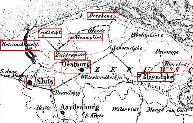
The ancestors of my mother came from 'West Zeelandic Flanders', in the south-west of Holland
This map is a current map with highways, the next cards are from about 1868.
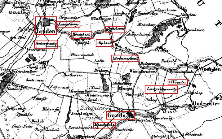
Because many names of places in the genealogy are not used anymore, I show a map of a part of South Holland from 1868.
Up to 1800 my ancestors lived in Moordrecht, Waarder and in Langeweide or Langeruigeweide, in the Gouda area.
After 1800 they moved to Leiderdorp and Leiden.
More maps can he seen on: Atlas 1868
(this map is copied with permission from Rob Kuijsten)
West Zeelandic Flanders is a part of the province Zeeland, where the ancestors of my mother lived.
More maps can he seen on: Atlas 1868
(this map is copied with permission from Rob Kuijsten)
N.B.:
In the Dutch WikipediA there is much more information about cities and history, select Languages: "Dutch".
You can translate pages on line to English, see: translate

 More maps can he seen on: Atlas 1868
(this map is copied with permission from Rob Kuijsten)
More maps can he seen on: Atlas 1868
(this map is copied with permission from Rob Kuijsten)
 More maps can he seen on: Atlas 1868
(this map is copied with permission from Rob Kuijsten)
More maps can he seen on: Atlas 1868
(this map is copied with permission from Rob Kuijsten)
